Category:Caledon Forest area maps
From Guild Wars 2 Wiki
Jump to navigationJump to search
Media in category "Caledon Forest area maps"
The following 21 files are in this category, out of 21 total.
 Dominion of Winds (area) map.jpg 502 × 2,177; 201 KB
 Dreamdark Enclave map.jpg 416 × 278; 46 KB
 Glencarn Sperrins map.jpg 1,214 × 907; 313 KB
 Grenbrack Delves map.jpg 585 × 906; 196 KB
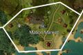 Mabon Market map.jpg 484 × 321; 51 KB
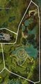 Morgan's Spiral map.jpg 672 × 1,365; 263 KB
 Ogham Wilds map.jpg 1,026 × 1,318; 399 KB
 Quetzal Bay map.jpg 1,027 × 2,021; 516 KB
 Ruins of the Unseen map.jpg 645 × 523; 120 KB
 Sandycove Beach map.jpg 1,215 × 858; 330 KB
 Sleive's Inlet map.jpg 768 × 708; 156 KB
 The Rootangles map.jpg 1,067 × 827; 314 KB
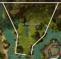 The Rowanwoods map.jpg 644 × 617; 123 KB
 The Verdence map.jpg 919 × 1,316; 405 KB
 Titan's Staircase map.jpg 651 × 809; 180 KB
 Trader's Green map.jpg 1,359 × 1,130; 504 KB
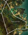
 Treemarch Estuary map.jpg 1,161 × 790; 270 KB
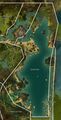
 Ventry Bay map.jpg 2,167 × 1,007; 606 KB
 Village of Astorea map.jpg 701 × 671; 162 KB
 Willowalk Groves map.jpg 1,000 × 757; 220 KB
 Wychmire Swamp map.jpg 1,109 × 1,758; 602 KB


_map.jpg)