Category:Diessa Plateau area maps
From Guild Wars 2 Wiki
Jump to navigationJump to search
Media in category "Diessa Plateau area maps"
The following 28 files are in this category, out of 28 total.
 Arcovian Foothills map.jpg 600 × 1,054; 178 KB
 Blackblade Lake map.jpg 1,479 × 1,120; 393 KB
 Bloodcliff Quarry map.jpg 862 × 684; 172 KB
 Breachwater Lake map.jpg 923 × 839; 194 KB
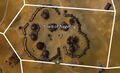
 Bulliyak Arsenal map.jpg 816 × 408; 98 KB
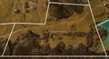
 Burrows of Moledavia map.jpg 1,095 × 766; 262 KB
 Flame Temple Tombs map.jpg 725 × 736; 143 KB
 Freewain Pastures map.jpg 1,313 × 1,424; 453 KB
 Gram Hills map.jpg 987 × 1,001; 283 KB
 Halrunting Plains map.jpg 838 × 1,058; 268 KB
 Holystone Caves map.jpg 458 × 1,191; 142 KB
 Incendio Templum map.jpg 987 × 918; 221 KB
 Manbane's Outcrop map.jpg 1,147 × 629; 195 KB
 Nemus Groves map.jpg 987 × 1,284; 304 KB
 Noxin Dells map.jpg 928 × 527; 115 KB
 Oldgate Clearing map.jpg 1,040 × 827; 213 KB
 Rancher's Wash map.jpg 823 × 1,346; 254 KB
 Reaper's Corridor map.jpg 728 × 871; 156 KB
 Ruins of Oldgate map.jpg 439 × 599; 61 KB
 Sanctum Way map.jpg 1,414 × 852; 311 KB
 Spider Nest Cavern map.jpg 700 × 656; 126 KB
 The Blasted Moors map.jpg 697 × 892; 168 KB
 The Breached Wall map.jpg 1,394 × 760; 252 KB
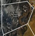 The Wurm's Gullet map.jpg 548 × 565; 87 KB
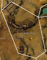
 Town of Nageling map.jpg 784 × 477; 95 KB
 Town of Nolan map.jpg 808 × 598; 143 KB
 Village of Butcher's Block map.jpg 479 × 583; 84 KB
 Wodron Glens map.jpg 1,010 × 872; 197 KB


