Category:Fireheart Rise area maps
From Guild Wars 2 Wiki
Jump to navigationJump to search
Media in category "Fireheart Rise area maps"
The following 25 files are in this category, out of 25 total.
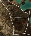 Amduat Point map.jpg 781 × 912; 180 KB
 Apostate Wastes map.jpg 1,314 × 1,256; 722 KB
 Buloh Crossing map.jpg 1,019 × 820; 195 KB
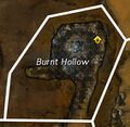 Burnt Hollow map.jpg 378 × 369; 74 KB
 Cozen Desolation map.jpg 692 × 758; 154 KB
 Forge Plains map.jpg 891 × 941; 227 KB
 Fuller Cistern map.jpg 1,084 × 1,043; 249 KB
 Havoc Steppes map.jpg 1,116 × 1,122; 314 KB
 Highland Thaw map.jpg 1,032 × 1,157; 561 KB
 Icespear's Shelf map.jpg 699 × 928; 310 KB
 Keeper's Sanctum map.jpg 871 × 1,111; 502 KB
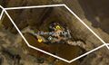 Liberation Dell map.jpg 576 × 346; 102 KB
 Mangonel Cavern map.jpg 928 × 672; 286 KB
 Onager Bivouac map.jpg 385 × 711; 132 KB
 Pig Iron Mine map.jpg 917 × 1,146; 471 KB
 Rebel's Seclusion map.jpg 490 × 864; 106 KB
 Rustbowl map.jpg 930 × 963; 235 KB
 Sati Passage map.jpg 1,082 × 802; 368 KB
 Simurgh Timberland map.jpg 1,053 × 1,404; 439 KB
 Sloven Pitch map.jpg 1,333 × 1,074; 622 KB
 Sweltering Canyons map.jpg 931 × 692; 189 KB
 Switchback Canyons map.jpg 1,199 × 1,203; 407 KB
 The Baelfire map.jpg 1,231 × 1,237; 333 KB
 The Toughstone map.jpg 921 × 761; 168 KB
 Vexa's Lab map.jpg 720 × 459; 168 KB


