Category:Lornar's Pass area maps
From Guild Wars 2 Wiki
Jump to navigationJump to search
Media in category "Lornar's Pass area maps"
The following 24 files are in this category, out of 24 total.
 Bouldermouth Vale map.jpg 643 × 1,165; 293 KB
 Chillwing Perch map.jpg 628 × 690; 161 KB
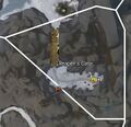
 Demon's Maw map.jpg 1,219 × 751; 335 KB
 Durmand Priory (location) map.jpg 588 × 995; 233 KB
 False Lake map.jpg 982 × 1,349; 514 KB
 False River Valley map.jpg 1,081 × 1,164; 491 KB
 Frostgate Falls map.jpg 625 × 717; 163 KB
 Griffonrook Run map.jpg 419 × 888; 154 KB
 Highfirn Passage map.jpg 750 × 1,168; 353 KB
 Icedevil's Needle map.jpg 1,184 × 619; 278 KB
 Jotun's Shoulders map.jpg 770 × 808; 239 KB
 Lake of Lamentation map.jpg 1,298 × 1,480; 704 KB
 Lost Delver's Ridge map.jpg 1,314 × 1,286; 673 KB
 Mistriven Gorge map.jpg 631 × 1,036; 271 KB
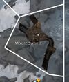 Molent Summit map.jpg 470 × 561; 104 KB
 Nentor Valley map.jpg 1,207 × 1,172; 553 KB
 Reaper's Gate map.jpg 667 × 643; 150 KB
 Refuge Peak map.jpg 905 × 1,305; 466 KB
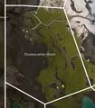 Stonescatter Wash map.jpg 706 × 809; 232 KB
 The Godspurs map.jpg 730 × 876; 253 KB
 The Thunderhorns map.jpg 865 × 1,132; 377 KB
 Underburg map.jpg 510 × 614; 119 KB
 Venison Pass map.jpg 1,054 × 960; 367 KB
 Winterthaw Snowfield map.jpg 1,539 × 805; 511 KB


_map.jpg)


