Category:Wayfarer Foothills area maps
From Guild Wars 2 Wiki
Jump to navigationJump to search
Media in category "Wayfarer Foothills area maps"
The following 28 files are in this category, out of 28 total.
 Borealis Forest map.jpg 1,083 × 808; 377 KB
 Breakneck Pass map.jpg 710 × 578; 161 KB
 Cragstead map (instance).jpg 518 × 886; 231 KB
 Cragstead map.jpg 518 × 886; 229 KB
 Darkriven Bluffs map.jpg 873 × 1,102; 397 KB
 Dawnrise Pass map.jpg 732 × 1,035; 263 KB
 Doldenvan Passage map.jpg 772 × 671; 208 KB
 Dolyak Pass map.jpg 1,136 × 764; 347 KB
 Frusenfell Creek map.jpg 719 × 971; 270 KB
 Grawlenfjord map.jpg 490 × 964; 189 KB
 Halvaunt Snowfield map.jpg 1,158 × 1,222; 515 KB
 Hangrammr Climb map.jpg 940 × 776; 350 KB
 Hunter's Lake map.jpg 997 × 798; 328 KB
 Icevine Dale map.jpg 919 × 671; 269 KB
 Kresdor Kenning map.jpg 374 × 764; 119 KB
 Moleberia map.jpg 619 × 852; 188 KB
 Molensk map.jpg 892 × 1,226; 415 KB
 Outcast's Cleft map.jpg 1,449 × 761; 430 KB
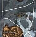
 Shaman's Rookery map.jpg 446 × 528; 115 KB
 Snowlord's Gate map.jpg 1,260 × 847; 425 KB
 Solitude Vale map.jpg 711 × 998; 270 KB
 Svanir's Dome map.jpg 761 × 1,004; 365 KB
 Taigan Groves map.jpg 880 × 739; 285 KB
 The Grekvelnn Burrows map.jpg 591 × 930; 220 KB
 The Icesteppes map.jpg 1,161 × 948; 416 KB
 The Osenfold Shear map.jpg 899 × 1,042; 397 KB
 The Shadowhorns map.jpg 622 × 641; 170 KB
 Wurmhowl Spikes map.jpg 416 × 581; 108 KB


.jpg)


